


- Stock: In Stock
- Product code: Survey Grade RTK Kit
- Weight Brutto: 0.30кг
More from this brand


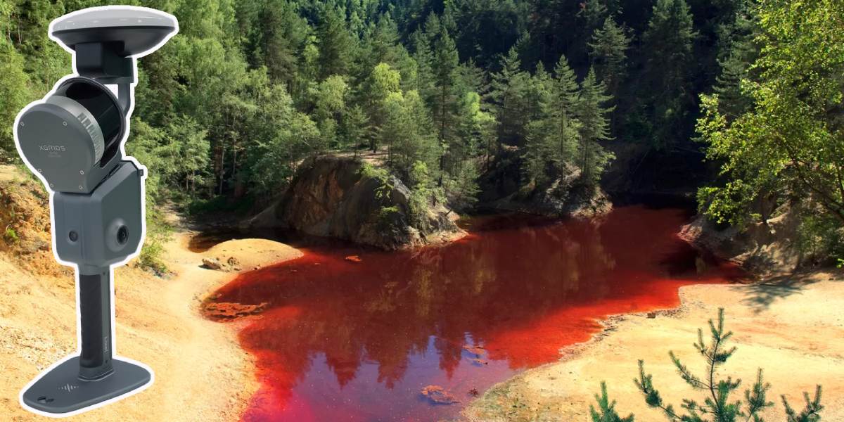
XGRIDS Survey Grade RTK Kit – precise positioning in challenging conditions
XGRIDS Survey Grade RTK Kit is an advanced survey-grade module designed for the XGRIDS Lixel L2 Pro series of LiDAR scanners. It provides accurate, real-time georeferencing of point clouds even where standard solutions struggle with signal loss: in forests, urban canyons, industrial zones, and areas with complex terrain. For open areas with a stable signal, the XGRIDS RTK Standard Kit is sufficient.
Key features of the Grade RTK Kit
- Reliable operation in conditions of unstable satellite signals.
- Positioning accuracy: horizontal – 0.8 cm + 1 ppm; vertical – 1.5 cm + 1 ppm.
- Compatibility with satellite systems: GPS (L1/L2/L5), GLONASS (L1/L2), Galileo (E1/E5a/E5b/E6b), BeiDou (B1/B2/B3).
- Package contents: Survey Grade RTK module, mounting bracket for XGRIDS Lixel L2 Pro, and a set of screws for quick installation.

Features and advantages of the XGRIDS 3D scanner accessory
Stable signal in a complex environment
The main difference between the Survey Grade version and the standard RTK is its increased stability in receiving corrective data. The module works confidently in conditions of limited sky visibility and maintains centimeter-level accuracy, which is critical for scanning in forests, among buildings, or in mountainous terrain.
Survey-grade accuracy
The professional level of positioning allows the XGRIDS scanner to be used not only for quick navigation but also for tasks that require compliance with surveying standards.
Reduced processing time
LiDAR data is immediately linked to coordinates in a global system. This reduces the need for lengthy post-processing and facilitates the integration of point clouds into GIS, BIM, or engineering projects.
Easy installation on the XGRIDS 3D scanner
The module is secured with just two screws. This makes it convenient for field use, where time and mobility are critical.
Where the Survey Grade RTK Kit is indispensable
Geodesy and topographic survey: when high accuracy is needed over large areas.
Urban planning and cadastral work: for building digital twins of objects and correctly integrating data into maps.
Engineering projects and construction (BIM): monitoring construction, controlling deformations, and verifying the compliance of actual objects with the design.
Forestry and ecology: measuring tree cover and building digital landscape models.
Archaeology and cultural heritage: accurate capture of historical objects even in areas with limited satellite signal access.
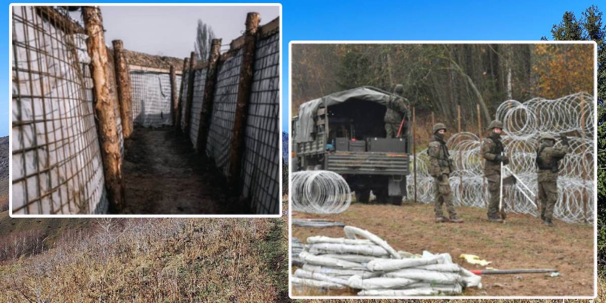
Emergency situations and military construction: rapid and accurate georeferencing of objects under time constraints and in complex environments.
Military application of the Survey Grade RTK Kit module
When considering the XGRIDS Survey Grade RTK Kit in military applications, its value lies in its ability to provide centimeter-level geopositioning accuracy for point clouds even in conditions where the GNSS signal is unstable (forests, mountains, dense urban areas). Below are several scenarios where such a module could be useful.
Engineering reconnaissance and planning
- Military engineers can use the LiDAR scanner with the RTK module for:
- rapidly building digital terrain models with precise coordinate referencing;
- analyzing the terrain for laying roads, bridges, and crossings;
- finding locations for fortifications, shelters, warehouses, and firing positions.
Construction of military infrastructure
- The RTK module provides the ability to accurately:
- mark out sites for temporary airfields, helicopter pads, and runways;
- control the geometry of structures (checkpoints, hangars, warehouses, barracks);
- quickly verify that the work performed matches the project data.
Camouflage and protection
- Accurate 3D scanning with RTK referencing allows for:
- finding natural camouflage objects (ravines, terrain folds, wooded areas);
- designing artificial shelters that blend with the terrain;
- analyzing areas that are visible or invisible to enemy observation and fire.
Coordination and compatibility with military systems
- The Survey Grade RTK Kit supports GPS, GLONASS, Galileo, and BeiDou. This is important for the military because it:
- increases resistance to interference and signal jamming;
- allows data to be integrated into military geographic information systems (GIS);
- ensures compatibility with correction stations that are often used at military sites.
Operational tasks
- Emergency situations: assessing damage after strikes or natural disasters, and planning evacuation routes.
- Reconnaissance and mapping: rapid data collection of unknown terrain with precise geographical referencing.
- Logistics: planning supply routes considering the actual terrain.
In military applications, the XGRIDS Survey Grade RTK Kit transforms a LiDAR scanner into a survey-grade tool that can build accurate digital maps even in a complex environment. This gives the army an advantage in reconnaissance, construction, camouflage, and infrastructure management. The XGRIDS Survey Grade RTK Kit is a solution for those who work in the field and cannot afford positioning errors. It combines:
- high accuracy (up to a centimeter),
- reliability in challenging conditions,
- ease of installation and compatibility with all major GNSS systems.
Qualified specialists from Center 3D Print can help you choose a 3D scanner for military applications and its accessories. Call us: we will quickly help you find the right equipment, provide consultation, and offer a discount. Free training, delivery in Poland.


-250x250.jpg "XGRIDS RTK Standard Kit – High-precision positioning module")


