


- Stock: In Stock
- Product code: L2 Pro 16/120
- Weight Brutto: 2.30kg
- SKU: 00-00012534
More from this brand


3D Scanner with Lidar XGRIDS L2 Pro 16/120 Standard Package
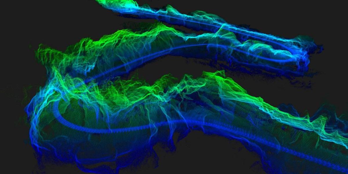
3D scanner with lidar XGRIDS L2 Pro 16/120 is an advanced handheld laser scanner. The device is designed to revolutionize 3D scanning and real-time modeling. The compact 3D scanner integrates advanced scanning technologies, visual sensors, and inertial measurement units (IMUs) with the use of artificial intelligence.
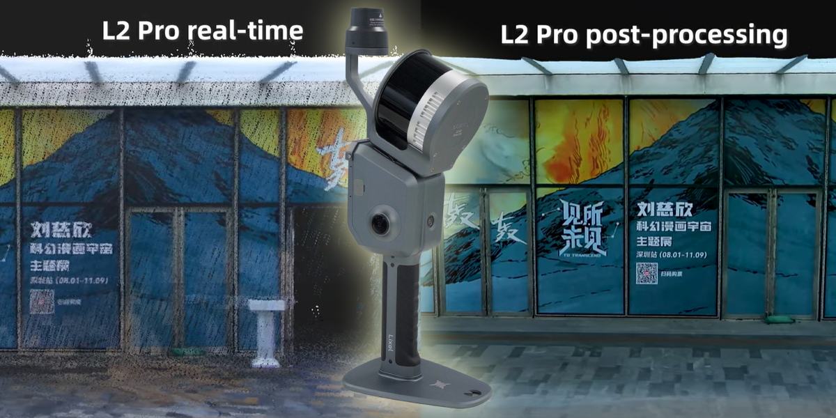
This ensures high-quality real-time point cloud data. Moreover, the data is of such high quality that it can compete with post-processed results. This opens a new era of "zero post-processing" for SLAM (Simultaneous Localization and Mapping) devices, significantly accelerating the workflow and increasing efficiency.
Key Advantages & Features
- Fast recording and instant visual control — ideal for field work.
- Real color model — for architecture, GIS, VR, construction.
- Portability and autonomy — a compact device without a large tripod.
- Good accuracy and data density — 1 mm/point, density up to 1 million points/m².
- The process can be difficult in dense forests — GCP marks are needed.
- IP54 (dust, drops) — insufficient protection for rain and mud.
- Scanner without RTK is inferior to a total station in geoposition accuracy, but within acceptable error — only ±3 cm.

Uniqueness and Principle of Operation XGRIDS L2 Pro 16/120 Standard Package
The uniqueness of Lixel L2 Pro lies in its ability to provide true real-time SLAM. The device instantly outputs point cloud data that is immediately ready for use without post-processing delays. Real-time coloring also achieves quality comparable to processed data, ensuring instant data readiness for further application.
The operating principle of the Lixel L2 Pro scanner is based on the full integration and deep optimization of updated sensors. It is equipped with a rotating scanner and a high-precision 6-degree-of-freedom IMU, which, combined with vision modules and artificial intelligence, allow obtaining accurate and detailed data about the environment.
The system provides stable and reliable navigation, even in difficult conditions. Panoramic vision with a resolution of 2×48 Megapixels allows obtaining high-quality images without the need for external cameras.
Difference in the operation of XGRIDS L2 Pro and Surphaser
How Surphaser works
Surphaser is a heliospherical (hemispherical) phase-shift laser scanner: the laser and mirror system rotate in two planes (360° vertically × 270° horizontally), reflecting the laser beam and capturing the precise geometry of objects.
The result is a dense point cloud set with sub-millimeter accuracy.

How XGRIDS L2 Pro works
The compact SLAM scanner combines a 360° LiDAR sensor with stereo/panoramic cameras (56 million pixels)
During scanning, the device executes SLAM algorithms to build a real-time model, providing a color 3D model with centimeter accuracy.
XGRIDS does not rotate mirrors like Surphaser, but uses mobile positioning, user movement, and continuous data processing.
Scanning with XGRIDS L2 Pro takes place in the following stages
1. LiDAR scanning
LiDAR (laser rangefinder) emits infrared laser pulses (905 nm) in all directions thanks to a rotating module. When a pulse reflects off an object, the scanner measures the signal's return time to calculate the distance to it. This forms a "point cloud" with a three-dimensional model of the space.
2. Digital camera for color
Built-in 48 MP panoramic cameras (often two) capture color images of the scene. These images are linked to the LiDAR cloud, creating a colored three-dimensional model (RGB points).
3. IMU + AI-SLAM
The integrated inertial module (IMU) tracks the device's movement and orientation. Thanks to SLAM (Simultaneous Localization And Mapping) algorithms, the scanner accurately determines its own position even without GPS.
4. Real-time data processing
The built-in computer instantly combines data from LiDAR, cameras, and IMU, forming a colored point cloud model without the need for further "serious" post-processing.
Four powerful algorithms deliver an extraordinary result that impresses even skeptics!
To obtain ready-to-use digital models, perform the following steps:
- Power on → LiDAR module rotation (~10 s), connection with camera/IMU
- Start scanning → laser moves and sends pulses → panoramas are captured in parallel
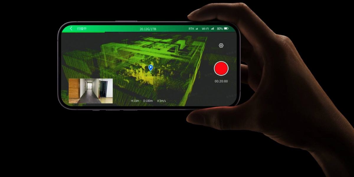
- AI + SLAM combine data in real-time → on phone/tablet, we see range and color cloud
- The cloud is saved as a .las file, then processed in Lixel Studio / CyberColor

Key characteristics and advantages of the XGRIDS L2 Pro 16/120 lidar scanner
High accuracy: Lixel L2 Pro demonstrates high accuracy performance. Absolute vertical and horizontal accuracy (RMSE) is 3 cm (without RTK and less than 100 m). Measurement accuracy (RMSE) is 2 cm (for distances between two points less than 100 m). Processing accuracy is even higher: absolute vertical and horizontal accuracy (RMSE) with GCP/RTK less than 100 m is also 3 cm. Measurement accuracy (RMSE) during processing reaches 1 cm, and repeatable accuracy (RMSE) is 2 cm.
Ultra-thin point clouds: Thanks to the unique LixelUpSample™ algorithm, the device generates photographic quality point clouds with a 1 mm step, creating dense point clouds with 1 million points per square meter. The point cloud thickness is 0.5 cm, which ensures high accuracy in mapping and line drawing.

Reliability in complex environments: The exclusive Multi-SLAM algorithm significantly improves the device's adaptability and reliability in conditions with limited satellite signal, such as indoors, underground spaces, subways, and tunnels, ensuring continuous acquisition of absolute coordinates and stable mapping.
Wide operating range: The scanner operates in the range from 0.5 m to 120 m.
High scanning speed: The scanning frequency is 320,000 or 640,000 points/s.
Long operating time: The continuous operating time of the device is 90 minutes.

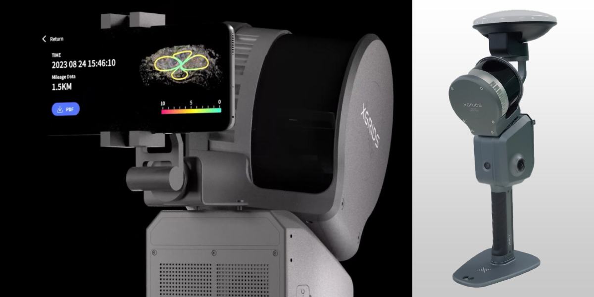
Convenient workflow: The device supports accurate verification reporting, direct phone connection, and a one-click GCP control point marking process.
Interfaces and memory: Lixel L2 Pro is equipped with a USB 3.1 Gen2 interface and has a built-in 1 TB SSD.
Wireless connections: WiFi (802.11a/b/g/n/ac) and Bluetooth are supported.
Protection class: The device has an IP54 protection class, which ensures its protection against minor water splashes.
RTK support: Lixel L2 Pro supports real-time RTK fusion. Standard RTK supports GPS L1/L2/L5, GLONASS L1/L2, BDS B1/B2/B3, Galileo E1/E5a/E5b/E6b channels with horizontal accuracy of 0.8 cm + 1 ppm and vertical accuracy of 1.5 cm + 1 ppm. Geodetic RTK has similar characteristics.
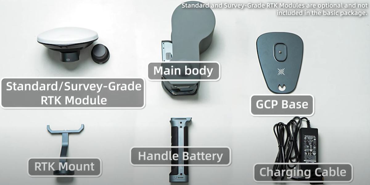
Auxiliary accessories: a backpack with stabilizing mount (60x60x15 cm, 2.5 kg), a backpack with soft padding (5x35x25 cm, 2.7 kg), a 2 m extension rod, a mobile phone mount, a control point plate, and a transport case (42x34x18 cm, weight with system 6.6 kg) may be available as part of the package or as additional accessories.
Software: The device supports LixelStudio 3.0 and Lyxel Cyber Color software for advanced point cloud processing capabilities and immersive 3D scenarios. The Lixel GO app provides convenient device control and real-time data access.
Application of 3D scanner with lidar XGRIDS L2 Pro 16/120
Lixel L2 Pro 16/120 Standard Package is a versatile solution for providing necessary 3D digital data in a wide range of industries, including topographic mapping, agricultural and forestry surveying, smart cities, engineering research, construction, inspection and maintenance, and film and game production.
Our qualified managers will help you choose a 3D scanner for your specific needs – call us!


-250x250.jpg "XGRIDS RTK Standard Kit – High-precision positioning module")


