


- Stock: In Stock
- Product code: L2 Pro 32/120
- Weight Brutto: 2.30kg
- SKU: 00-00012536
More from this brand


3D Scanner for Landscape Scanning XGRIDS L2 Pro 32/120
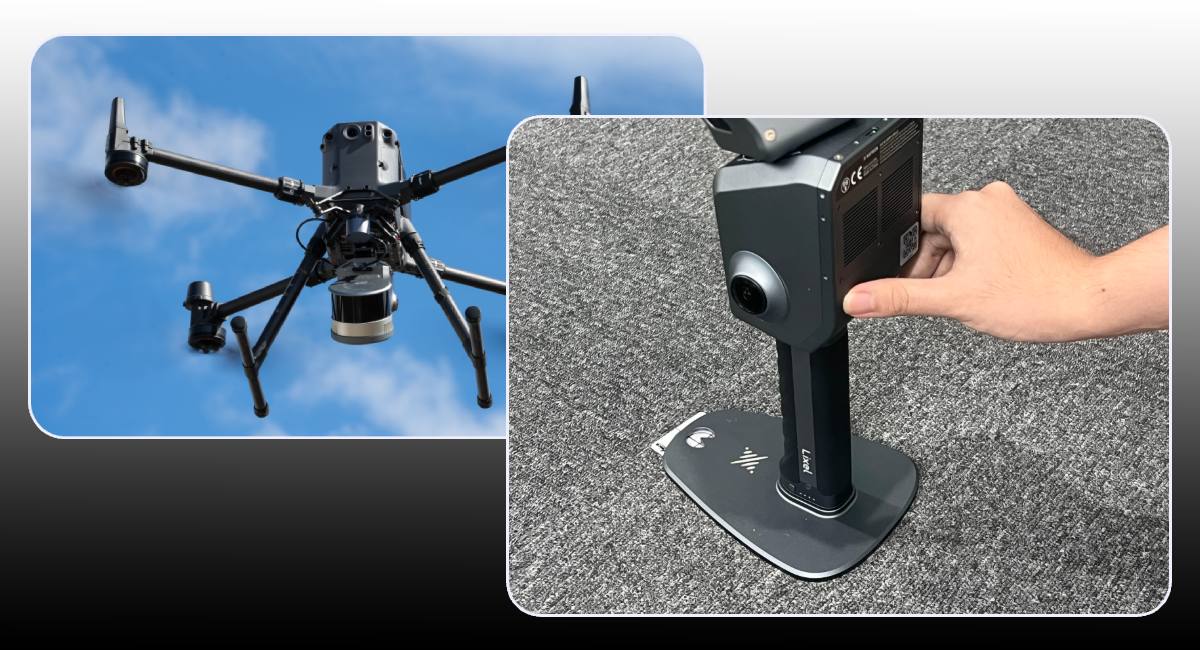
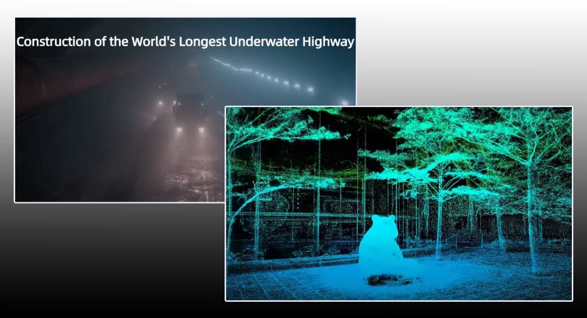
The XGRIDS L2 Pro 32/120 landscape scanner is a professional device for volumetric 3D fixation of large areas. It combines a LiDAR sensor with 32 channels, an IMU module, and two 48 MP panoramic cameras each. This combination allows for real-time acquisition of colored point clouds with almost no subsequent processing – the quality is close to post-processing thanks to the LixelUpSample™ algorithm. The parameters of the 3D scanner allow it to be used for a wide range of tasks, from the gaming industry to landscape design.
Technical Specifications XGRIDS L2 Pro 32/120
- Field of view reaches 360°×270°, covering the maximum scanning area in one pass
- Scanning speed — up to 640,000 points/s, allowing details to be captured with hundreds of millions of points per hour
- LiDAR channels: 32
- Maximum range: up to 120 m
- Scanning speed: up to 640,000 points/s
- Density: up to 1 million points/m², step ~1 mm
- Relative accuracy: ~1 cm
- Absolute accuracy: ~3 cm
- Image format: colored clouds .LAS, .PLY; photos .JPG
- Cameras: 2×48 MP, panoramic
- LiDAR class: Class 1, wavelength 905 nm
- Operating time: up to 1.5 hours on battery
- Memory: 1 TB internal SSD
- Interfaces: USB 3.1 Gen 2; Wi‑Fi / Bluetooth
- Dimensions / weight: 180×130×400 mm, ≈1.7 kg without battery
- Operating temperature range: –20 °C…50 °C
- Protection: IP54
- The 32/120 model provides a balance of range and density — up to 120 m coverage and 640,000 points/s scanning.
Features of the XGRIDS L2 Pro 32/120 3D Scanner
- Zero post-processing: thanks to the integration of IMU, cameras, and AI algorithms, the device creates almost analysis-ready points immediately after scanning.
- RTK compatibility: RTK module support ensures high-precision geopositioning in challenging conditions.
- Control interface: simple control via screen, LixelGO mobile app, and built-in functions: RTK setup, pausing and resuming scanning, preview — all available on one device.
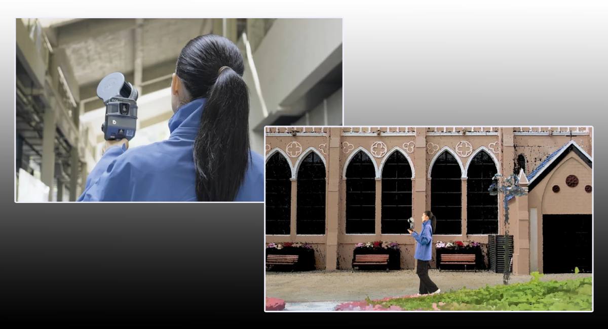
Portable XGRIDS 3D Scanner – Usage
- Topographic surveying and engineering measurements;
- Creation of Digital Twins of buildings and infrastructure;
- BIM, architectural monitoring, film and game production;
- Cultural heritage, forestry, and surveys in remote or difficult conditions.
High-Precision 3D Scanner for Large Areas – A Gift for Users!
The L2 Pro 32/120 is suitable for professionals who need maximum accuracy, range, and data realism. While previously point clouds had to be processed manually, now most of the work is done in real-time, without unnecessary steps.
Advantages of the XGRIDS L2 Pro 32/120 Landscape Scanning Device
- Very high detail of point models (1 mm between points);
- Color clouds with quality close to post-processing;
- Can work autonomously — built-in 1 TB SSD, operating time up to 1.5 hours;
- Reliability even at temperatures down to –20 °C and humidity (IP54).
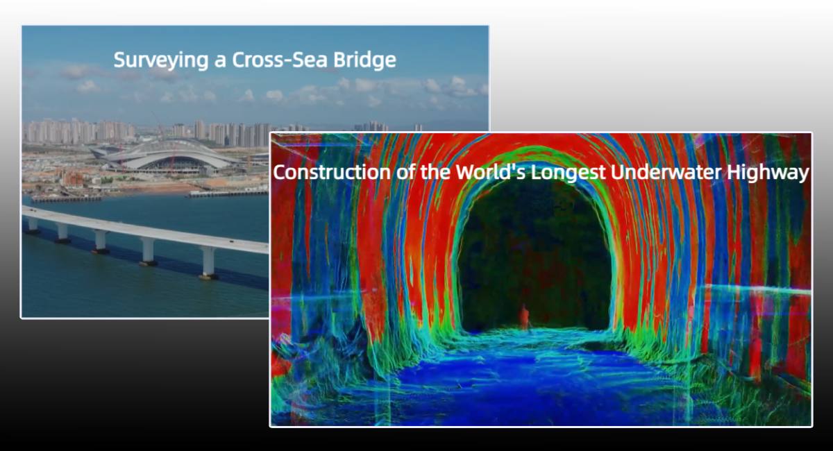
Application Areas of XGRIDS L2 Pro 32/120
The XGRIDS L2 Pro 32/120 3D scanner is used in a wide variety of industries due to its versatility, accuracy, and scanning speed:
Construction and Architecture
Used for digital fixation of objects, scanning facades, interiors, and construction sites. Allows for the creation of BIM models, monitoring construction chronology, and identifying deviations.
Cartography and Geodesy
Used for rapid terrain surveying, creation of topographic maps, 3D terrain models. RTK support ensures centimeter-level positioning accuracy.
Urban Cadastre and Planning
The scanner helps fix street objects, utility networks, building facades. Used for updating cadastral databases and 3D modeling of the urban environment.
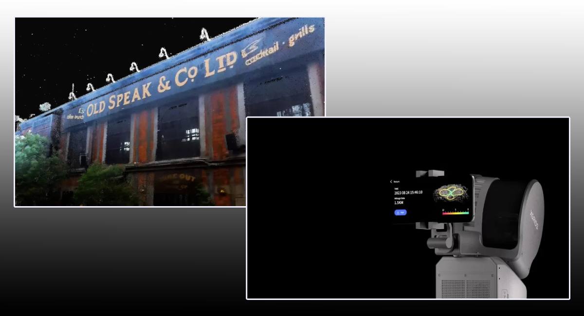
Cultural Heritage Preservation
High detail (up to 1 mm) makes it ideal for scanning historical objects, monuments, museums. Color clouds allow for the creation of accurate digital copies.
Industry and Factory Logistics
Applied for 3D auditing of production workshops, reconstruction, equipment placement planning, and ensuring installation accuracy.
Forestry and Agriculture
Allows for forest inventory, vegetation monitoring, and building digital landscape models.
Forensics and Emergency Surveys
Used for fixing crime scenes, documenting damage, assessing damage — even in poor visibility or limited time conditions.
3D scanner XGRIDS L2 Pro32/120 Standard Package
The standard package includes everything you need to start up and operate the equipment efficiently from the very first minutes:
- XGRIDS L2 Pro Handheld Scanner (32 channels, 120m range)
- L2 Series Handle Battery — provides autonomous operation up to ~1.5 hours
- Charger & Converter for power and charging
- GCP Plate (Ground Control Point Collection Plate) for installing control points during geolocation
- USB-C Cable (Type C Cable) for data transfer and connection
- Rugged protective case (Product Case) for storage and transportation
- Lixel Studio Software License — a complete package for processing, editing and visualizing point clouds
- Quick Start Guide with step-by-step instructions for launching
- Warranty Card — confirmation official support and service
Optional accessories (not included in the standard package)
- RTK-kit (Standard or Survey Grade)
- Smartphone holder
- Extension Pole
- Carrying module backpack
Media and Virtual Reality
Allows for the creation of realistic scenes and textures for films, video games, and VR/AR content.
Thanks to its autonomy, mobility, and high accuracy, the XGRIDS L2 Pro 32/120 is suitable for both field work and precise indoor measurements. Choose XGRIDS L2 Pro – you'll definitely like the price!


-250x250.jpg "XGRIDS RTK Standard Kit – High-precision positioning module")


