


- Stock: In Stock
- Product code: 827588000000916893
- Weight Brutto: 0.17kg
- SKU: CZ02020001
More from this brand


GRIDS K1 RTK Module – precise real-time positioning
The XGRIDS K1 RTK Module enhances the Lixel K1 LiDAR scanner, providing georeferencing with centimeter accuracy directly during the scanning process. This allows for obtaining absolutely accurate cloud point coordinates without complex post-processing. The RTK Module is indispensable when not only speed but also accuracy is important when scanning complex terrain. The RTK (Real-Time Kinematic) module allows you to get an accurate digital terrain model in real time.
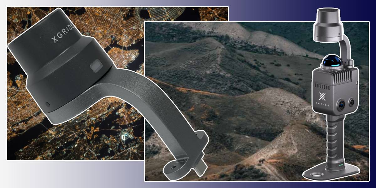
Fast integration and reliable operation of the additional module for Lixel K1
The module was created in such a way that its mounting to the Lixel K1 body is simple and reliable. The connection takes a minimum of time and does not require complex tools. After installation, you should set the NTRIP server parameters in the LixelGo application, and the module's indicator will turn green, which indicates a stable fixed RTK solution
Convenient workflow and 3 cm accuracy
Using RTK, you get an absolute positioning accuracy of up to 3 cm — unattainable with standard SLAM navigation. Data is immediately saved with satellite coordinates, minimizing errors at all stages. Subsequently, when processed in LixelStudio, RTK data is automatically integrated into the point cloud while maintaining correct georeferencing
Advantages of the XGRIDS K1 RTK Module
- Instant georeferencing: eliminates the lengthy stage of post-processing and manual alignment.
- Maximum accuracy: absolute geopositioning with an error of up to 3 cm, relative — about 1.2 cm.
- Reliability and adaptability: smooth operation in conditions of unstable SLAM signal.
- Time saving: scanning and positioning are performed in one pass.
- Versatility: easily integrates into a mobile LiDAR scanner without increasing weight and complexity.

Feasibility of using the XGRIDS K1 RTK module in different areas
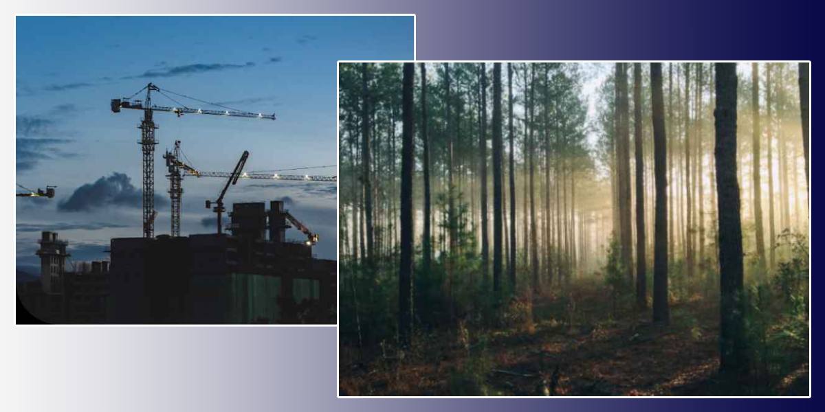
Engineering and construction tasks
The module is ideal for controlling the exact position of infrastructure objects, such as foundations, engineering communications, road pavement. Post-processing is eliminated, which speeds up the "survey — analysis — implementation" cycle.
Cartography and land management
For topographic surveys and cartographic needs, absolute RTK data is critically important. Especially when creating digital terrain models, cadastral breakdown, cadastral boundaries.
Archeology and cultural heritage
When scanning patterns, artifacts, and historical objects, georeferencing precisely corresponds to real space. The module eliminates the need for subsequent data correction, which is important when taking into account small details.
Digital twins and architecture
In architecture, "Smart City" and the virtual reality industry, RTK accuracy allows you to create accurate and visually reliable digital copies of buildings, streets, and spaces, which are integrated into GIS and CAD systems.
Agriculture and forestry
When surveying agricultural lands and forest territories, the RTK module ensures accuracy in large-scale landscape projects, where even a small error affects volume calculations or location.
Critically important military tasks
Here the module proves itself especially well:
- Georeferencing of military objects: fortifications, runways, communication facilities — planning and placement are performed with scene accuracy.
- Fast geodesic assessments: when preparing for operations or construction of equipment, the module provides accurate data instantly without long analysis.
- Navigation and cartography at bases: ensures the creation of maps with correct coordinates, compatible with navigation and GIS systems.
- Engineering reconnaissance and camouflage: allows you to instantly create a digital terrain model with accurate coordinates for placing shelters, calculating routes.
Using the XGRIDS K1 RTK module is critically important if you need to:
- get scenes with world-value coordinates right in the field;
- integrate scans into GIS, CAD, or BIM without recalibration;
- speed up the workflow from scanning to the final result;
- perform cartography, archaeological, or architectural scanning with absolute accuracy.
In the above scenarios, the XGRIDS K1 RTK Module can provide the necessary accuracy, scalability, and speed.
The XGRIDS K1 RTK Module is an indispensable accessory for professionals who value accuracy, speed, and reliability. It strengthens the Lixel K1 mobile LiDAR scanner, providing georeferencing with an accuracy of up to 3 cm in real-time, shortens post-processing stages, simplifies workflows, and expands the range of applications — from engineering tasks and cultural heritage to military and strategic operations. When every centimeter of geolocation is important, this module becomes a key tool. You can choose accessories for 3D scanners of different brands in the 3D accessories' category. Have questions? Call, write: all communication channels are listed on the Contacts page.


-250x250.jpg "XGRIDS RTK Standard Kit – High-precision positioning module")


