


- Stock: In Stock
- Product code: L2 Drone Mount
- Weight Brutto: 1.00kg
More from this brand


XGRIDS L2 Drone Mount – mount for fixing L2 series 3D scanners on drones
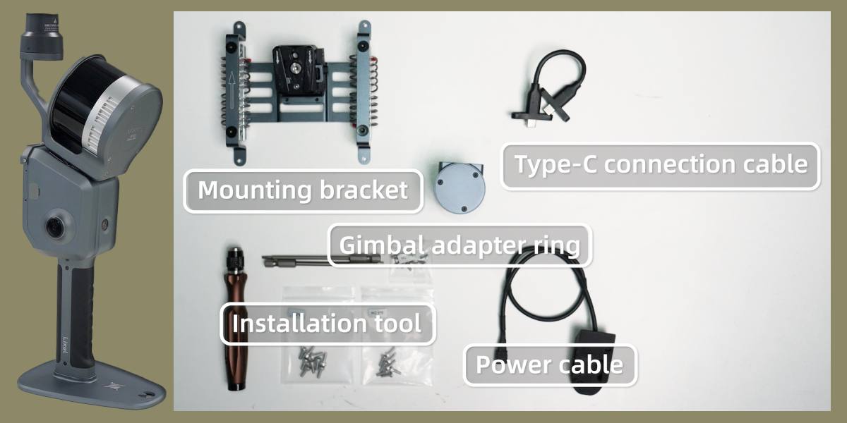
Bracket for mounting 3D scanner to a Drone
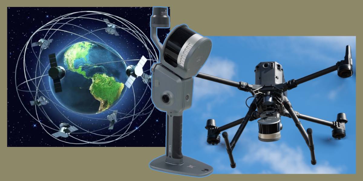
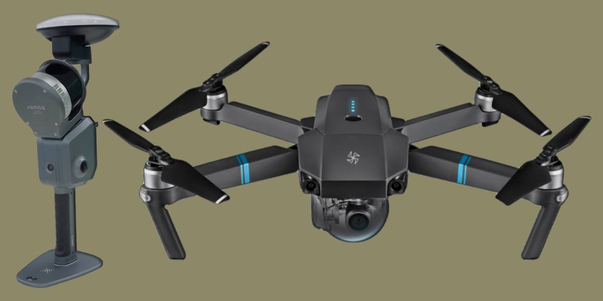
XGRIDS L2 Drone Mount is a specialized mount developed for installing XGRIDS Lixel L2 and L2 Pro mobile LiDAR scanners on industrial drones DJI M300 RTK and M350 RTK. With this accessory, the operator gets the opportunity to use the full potential of XGRIDS 3D scanners in aerial missions, combining LiDAR accuracy and drone mobility.
Key features and properties of XGRIDS L2 Drone Mount
- Compatibility: suitable for XGRIDS Lixel L2 and L2 Pro models (16-channel and 32-channel versions).
- Carrier Drones: DJI Matrice 300 RTK and DJI Matrice 350 RTK.
- Construction: lightweight and rigid, minimizing vibrations during flight.
- Functionality: allows collecting true-color point clouds with high relative accuracy up to 2 cm.
- Reliability of fixation: the mount is designed considering the load and flight dynamics, which eliminates displacement and vibration of the scanner.
Features and advantages of using the XGRIDS drone bracket
Secure fixation of the 3D scanner on the Drone
The mount guarantees a stable hold of the scanner on the drone, eliminating play and oscillations, which directly affects the quality of LiDAR scanning.
High accuracy of scanning data
In combination with RTK modules, XGRIDS scanners provide centimeter accuracy, and the Drone Mount allows these capabilities to be realized in aerial scanning.
Efficiency of digitizing large areas
The mount is easily installed on the DJI platform, allowing the system to be quickly prepared for work in the field.
Versatility of using Drone Mount
Using the Drone Mount expands the scanner's usage scenarios – from ground surveys to aerial mapping of large territories.
Areas of application for the bracket for mounting a 3D scanner to a Drone
Civilian tasks
Aerial mapping and topography – creation of accurate digital terrain models, territory planning, cadastral work.
Construction and infrastructure – monitoring construction progress, control of objects (bridges, roads, tunnels, power lines).
Forestry and ecology – analysis of vegetation, accounting for timber resources, environmental monitoring.
Agriculture – mapping fields and analyzing the condition of crops.
Military and special tasks
- Reconnaissance and engineering preparation – rapid 3D assessment of terrain and buildings for operation planning.
- Creation of digital maps of destruction – assessment of the consequences of strikes, precise determination of zones for restoration or camouflage.
- Construction of temporary infrastructure – airfields, crossings, shelters, where operational topographic surveying is required.
- Tactical planning – modeling of shelters, supply routes, and defensive positions.
How XGRIDS L2 Drone Mount is useful
- Expands the capabilities of L2 and L2 Pro scanners, turning them into an aerial LiDAR complex.
- Ensures reliability and stability in flight, which is critical for data accuracy.
- Allows large-scale surveys to be performed in the shortest possible time.
- Compatible with proven industrial DJI platforms, which are widely used in both civil and military sectors.
XGRIDS L2 Drone Mount is not just a mount, but a key accessory that opens up new horizons for using L2 series LiDAR scanners. It allows the effective use of XGRIDS technologies in aerial scanning, providing a combination of mobility, accuracy, and versatility. For civilian specialists, it is a tool for topography, ecology, and infrastructure projects. For the military – the ability to quickly obtain accurate digital models of the terrain and objects, which directly affects the success of mission execution.
You can choose a 3D scanner and accessories for both civilian and military tasks. Call us: our experienced managers will consult, answer all questions, and help you not get lost among the multitude of brands and models. We will help you organize your work processes at a new technological level, increase productivity, and expand your range of services.
Technical features of connecting 3D scanners to drones
The XGRIDS mount for drones allows you to install and connect the L2 Pro scanner to DJI drones. It is compatible with the DJI M350 RTK and DJI M300 models and supports both the 16-channel and 32-channel versions of the Lixel L2 Pro.
| Indicator | Specifications of the L2 Pro drone mounting bracket |
| Absolute accuracy | RMS: 6 cm |
| Relative accuracy | 2 cm |
| Repeatability | 3 cm |
| Point cloud thickness | 2 cm |
| Colorization | Supported |
| 3DGS | Not supported |
| Point cloud improvement | Not applicable |
| Map merging | Not applicable |
| Material | Metal |
| Weight of mounting bracket | 408 g |
| Total weight with L2 PRO | 2.2 kg (XT-16, XT-32)
1.9 kg (XT-32M) |
| Power source | DJI Drone |
| RTK accuracy (RMS) | Horizontal: 1 cm + 1 ppm
Vertical: 1.5 cm + 1 ppm |
| Usage scenario | Recommended flight altitude: 30 m
Recommended flight speed: 3 m/s Maximum flight altitude: 50 m Maximum flight speed: 5 m/s |


-250x250.jpg "XGRIDS RTK Standard Kit – High-precision positioning module")


